IDQ20018
TROPICAL CYCLONE TECHNICAL BULLETIN: AUSTRALIA - EASTERN REGION
Issued by AUSTRALIAN BUREAU OF METEOROLOGY TROPICAL CYCLONE WARNING CENTRE
at: 1307 UTC 07/02/2024
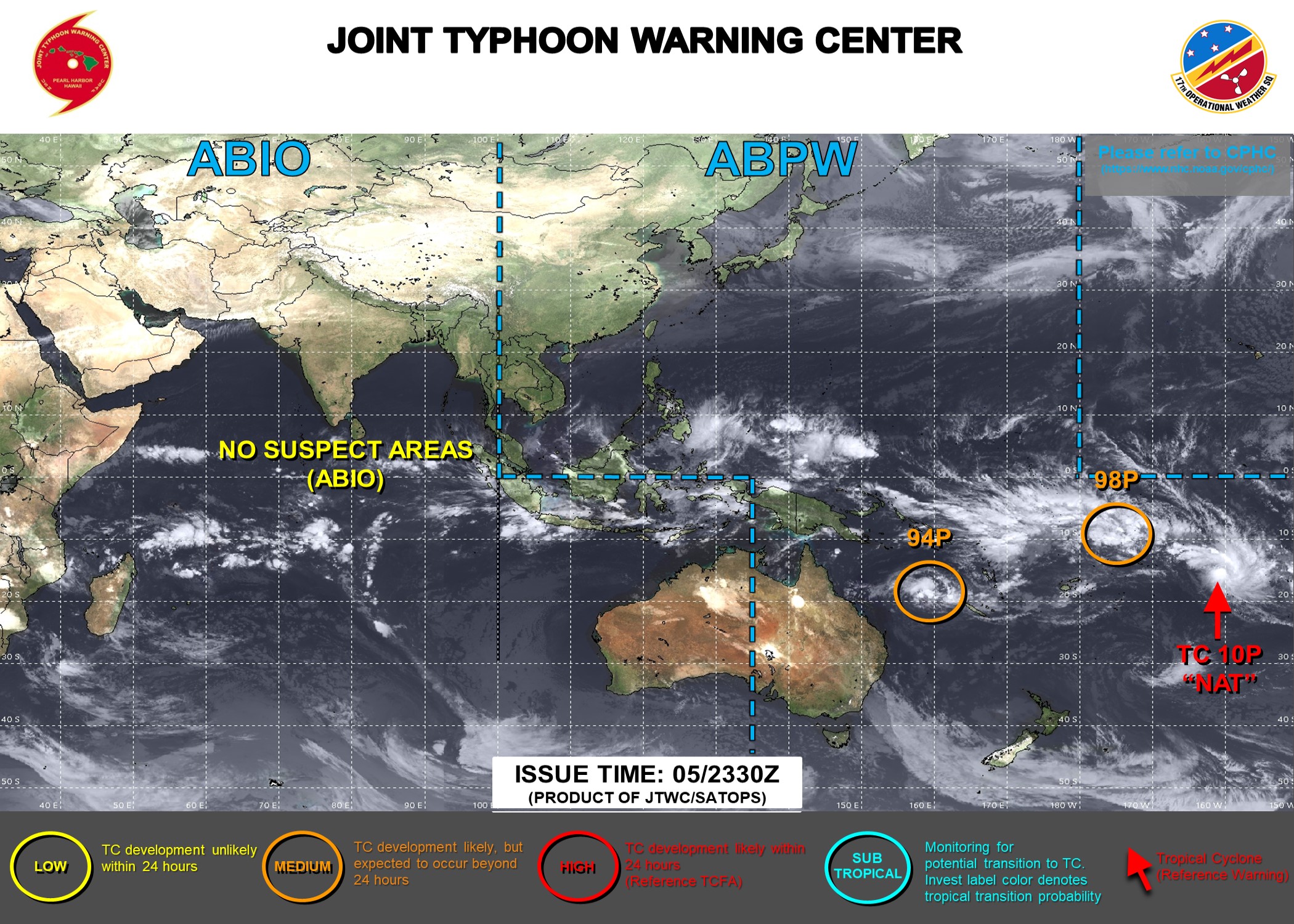
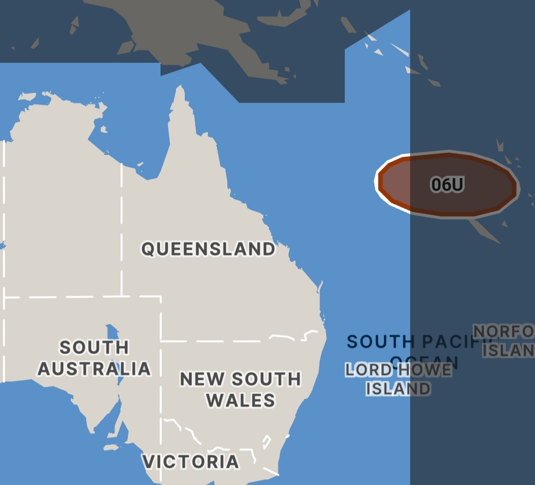
Name: Tropical Low
Identifier: 06U
Data At: 1200 UTC
Latitude: 15.7S
Longitude: 159.8E
Location Accuracy: within 30nm (55 km)
Movement Towards: northeast (052 deg)
Speed of Movement: 5 knots (9 km/h)
Maximum 10-Minute Wind: 25 knots (45 km/h)
Maximum 3-Second Wind Gust: 45 knots (85 km/h)
Central Pressure: 998 hPa
Radius of 34-knot winds NE quadrant:
Radius of 34-knot winds SE quadrant:
Radius of 34-knot winds SW quadrant:
Radius of 34-knot winds NW quadrant:
Radius of 48-knot winds NE quadrant:
Radius of 48-knot winds SE quadrant:
Radius of 48-knot winds SW quadrant:
Radius of 48-knot winds NW quadrant:
Radius of 64-knot winds: nm ( km)
Radius of Maximum Winds: nm ( km)
Dvorak Intensity Code: T2.0/2.0/D0.5/24HRS STT:S0.0/06HRS
Pressure of outermost isobar: 1004 hPa
Radius of outermost closed isobar: 240 nm (445 km)
FORECAST DATA
Date/Time : Location : Loc. Accuracy: Max Wind : Central Pressure
(UTC) : degrees : nm (km): knots(km/h): hPa
+06: 07/1800: 15.6S 160.5E: 045 (085): 030 (055): 999
+12: 08/0000: 15.6S 161.3E: 060 (105): 030 (055): 999
+18: 08/0600: 15.8S 162.2E: 070 (125): 030 (055): 999
+24: 08/1200: 16.0S 163.0E: 075 (140): 030 (055): 999
+36: 09/0000: 17.0S 164.0E: 080 (150): 035 (065): 996
+48: 09/1200: 17.8S 165.1E: 105 (195): 045 (085): 991
+60: 10/0000: 18.5S 166.5E: 130 (240): 055 (100): 982
+72: 10/1200: 19.0S 167.9E: 155 (285): 050 (095): 985
+96: 11/1200: 19.2S 169.8E: 200 (370): 040 (075): 992
+120: 12/1200: 19.1S 170.0E: 270 (500): 030 (055): 998
REMARKS:
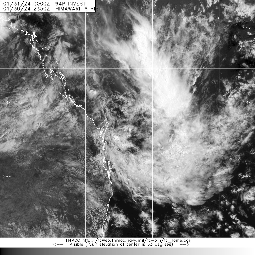
The structure of 06U has gradually improved over the last 24 hours and it may
develop into a tropical cyclone by Friday.
The low has been located using animated IR imagery with only moderate
confidence. Curved banding has been analysed with a wrap of up to 0.5 at times,
however the curvature is not tightly wrapped around the centre but instead
orientates along a trough to the north. DT is 2.5 with MET and PAT at 2.0.
FT/CI held at 2.0 based on MET/PAT. There is currently no objective intensity
guidance available. Current intensity is set at 25 knots based on Dvorak and
model guidance.
The environment is moderately favourable for development with 06U located over
warm SSTs with good upper divergence and low shear. A limiting factor seems to
have been the very dry air surrounding the system, coupled with strong middle
level westerlies just to the north of the centre. Models indicate some
development is possible in the next 24 to 48 hours as an upper trough to the
southwest increases outflow aloft, however this could be countered by dry air
entrainment that may come from the mid-level westerlies. Any window for
development may be short lived as from Saturday models are broadly consistent
with upper winds increasing and the effects of dry air becoming more
pronounced.
Steering is being governed by the mid-level westerlies to the north of the low
and movement is forecast to be slowly to the northeast for the next 24 hours. A
very weak mid-level low to the south intensifies to the southwest of 06U during
Friday and the system begins to move to the east southeast under this
influence. Movement is then expected to be slow as the system weakens. From
next Monday or Tuesday the shallow remnant low will most likely steer towards
the west northwest due to a low level ridge to the south.
Copyright Commonwealth of Australia
==
The next bulletin for this system will be issued by: 07/1930 UTC.